Dogs Off-leash

E-Bikes
Unknown
Features
Drops/Jumps

This is a National Forest. Hunting is allowed, even on Sunday. Check deer, turkey, and bear hunting seasons.
Overview
An excellent, long ride with all the roots, rocks, log jumps, boulder hucks, gully and creek crossings you crave. It's mostly downhill, with several punchy climbs, ending with fun water bars.
This trail is part of the Yew Mountain Doozy, a 69 mile ride that feels like 70.
facebook.com/WVDoozy
Need to Know
Keeping this trail clear is a community project. We need your help. Carry a razor saw and hand clippers if you want to help us, please! This is adventure mountain biking - no cell phone coverage, few easy exits. Take plenty of water and rain gear if any question of rain. Expect a creek crossing at mile six. There is a spring on the left (running water over rock above road) part way up Bear Run Rd - before the 1st switchback. Drink at your own risk.
Best finish is now the Desert Branch section of Fork Mtn trail. It sports two new reroutes around the beaver pond.
A neat bed and breakfast is available in Marlinton, WV - The Old Clark Inn
oldclarkinn.com/ Also, there is a nice Air B&B in Richwood called the Cottage. Pizza available at Hole in Wall in Richwood. There is a good, new place to eat in Richwood - The Whistlepunk.
Description
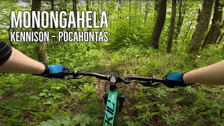
Set a shuttle in Richwood, then drive east on Hwy 39/55 to Kennison Mtn. Begin at the Kennison Mtn parking lot and cross Hwy 39/55 heading south on
Kennison Mountain Trail skirting Blue Knob to the west. Turn right on
Pocahontas Trail #263, crossing a grassy road heading west. Alternatively, you can start at the Cranberry Nature Center on Hwy 39/55 and head West on
Pocahontas Trail #263, this makes the full ride about 30 miles and begins with significant climbing. At the intersection of
Pocahontas Trail #263 and
Fork Mountain Trail - East Section, go left.
Follow the singletrack for a climb and descent that leads over Hill Creek (rideable unless just after a rain). When you encounter a paved trail, follow it to the Falls of Hills Creek parking lot. From there, continue to Highway 39/55 and turn left (west) for just over a mile-and-a-half of easy paved pedaling to reach
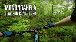
Bear Run Road.
A four mile gravel road climb takes riders to the top of Fork Mountain and handily avoids the
Fork Mountain Trail - Water Bar Section which would be absolute misery to try and climb because of the massive water bars. At the top, continue on the
Fork Mountain Trail - Ridge Section for 13-miles of rugged and scenic singletrack that follows the trace of a hand-laid road.
When you come to the gravel road (
FSR #946), go straight across the gravel road and follow the lower section of
Fork Mountain Trail - Desert Branch Descent downhill to the Gauley Ranger station. This section has new (as of Oct. '19) bridges and a reroute around the beaver pond, which makes it a fun singletrack finish, pretty rocky though, so if you've had enough roughness, take the gravel road (FSR 946) to Richwood.
A fun variation is to turn right on North Bend Trail, 13 miles West of
Bear Run Road. North Bend is a fun and fast downhill that ends at the North Bend picnic area on Hwy 39.
You can ride this as a 72-mile loop for the very fit, known locally as the Yew Mountain Doozy - check its Facebook page. Yes, there really is one,
click here.
History & Background
Fork Mountain Trail was an old road built by the CCC in the 1930s, grown into a singletrack now. The half-dozen rock gardens were part of the stone road that has been jumbled up by tree roots. The tree roots couldn't get to one section that looks like hand-laid tile. Good chance of seeing wildlife in the form of animals or people.
This ride is part of a planned 500-mile bike trail network thanks to the Appalachian Regional Commission to diversify the economies former coal mining communities. Lots of mining and logging history in this area - check the Richwood visitor center, or chat with the locals at the DQ. Show an interest in their history, and you'll be treated to some engaging stories, such as that of Quinnwood, just to the south, that was known in the day as the "million mule town" (mule powered mining). The mules are gone now, but the jackasses are still there.
Contacts
Shared By:
Steve Jones
with improvements
by Robin Bruns

 Continue with onX Maps
 Sign in with Facebook


 Intermediate/Difficult


10 Comments