
 Continue with onX Maps
 Sign in with Facebook


Top Recommended MTB Rides
near Trenton, Kentucky
Trenton, Kentucky 
Recommended Routes, Photos, & More


 Intermediate
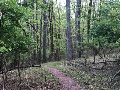
Land Between the Lakes Canal Loop
10.6 mi 17.1 km • 1,546' Up 471.35 m Up • 1,548' Down 471.69 m Down

 Calvert…, KY
 Intermediate
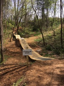
Lock 4 Mountain Bike Trail
7.1 mi 11.4 km • 444' Up 135.32 m Up • 443' Down 134.94 m Down
Gallatin, TN
 Intermediate/Difficult
Chickasaw Trace Mountain Bike Trail
8.1 mi 13.0 km • 517' Up 157.65 m Up • 505' Down 153.83 m Down
Columbia, TN
 Intermediate
Big Hollow at Mammoth Cave
11.7 mi 18.9 km • 598' Up 182.19 m Up • 594' Down 181.2 m Down
Brownsv…, KY
 Intermediate/Difficult
Hamilton Creek Mountain Bike Trail
11.1 mi 17.9 km • 684' Up 208.48 m Up • 684' Down 208.4 m Down
 Intermediate
Cane Ridge Loop
4.5 mi 7.3 km • 222' Up 67.55 m Up • 221' Down 67.47 m Down
Lavergne, TN
 Intermediate/Difficult
Shutes Branch MTB Trail
7.1 mi 11.4 km • 361' Up 110.11 m Up • 374' Down 113.98 m Down
Green Hill, TN
 Intermediate
Rudy Mine Trail
7.8 mi 12.6 km • 503' Up 153.35 m Up • 500' Down 152.33 m Down
Owensboro, KY
 Intermediate/Difficult
Livingston County Trail System
13.3 mi 21.4 km • 591' Up 180.17 m Up • 598' Down 182.38 m Down
Calvert…, KY
 Intermediate/Difficult
Brier Creek
8.0 mi 12.9 km • 615' Up 187.31 m Up • 614' Down 187.27 m Down
Brownsv…, KY
 Intermediate
Percy Warner Park Hookman Hill Loop
2.8 mi 4.5 km • 240' Up 73.09 m Up • 239' Down 72.83 m Down
 Intermediate/Difficult
O'Face MTB Race Route
9.8 mi 15.7 km • 999' Up 304.51 m Up • 1,002' Down 305.3 m Down
Goreville, IL
 Intermediate
Twisted Oliver Trail
3.2 mi 5.1 km • 326' Up 99.28 m Up • 325' Down 99.03 m Down
Scottsv…, KY
 Intermediate
Toy Box, Boulevard, Wabash
4.5 mi 7.3 km • 385' Up 117.2 m Up • 385' Down 117.29 m Down
Belle M…, TN
Intermediate
Cane Ridge 1-4
8.9 mi 14.3 km • 476' Up 144.97 m Up • 472' Down 143.84 m Down
Lavergne, TN
 Intermediate
Grapevine Lake
8.1 mi 13.1 km • 398' Up 121.25 m Up • 398' Down 121.17 m Down
 Intermediate/Difficult
Jones Mill Full Loop
9.0 mi 14.4 km • 523' Up 159.39 m Up • 526' Down 160.27 m Down
Rural Hill, TN

 Easy
Easy
Freeman Lake Greenbelt Trail
5.6 mi 9.0 km • 79' Up 24.19 m Up • 80' Down 24.46 m Down
 Intermediate/Difficult
Middleberg/Columbia State Trails
1.2 mi 1.9 km • 126' Up 38.51 m Up • 115' Down 34.98 m Down


