
 Continue with onX Maps
 Sign in with Facebook


 Intermediate

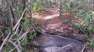
“A gravel fire road that connects the Lake Imaging parking lot to Buck Forest Road. ”


1.6
Miles2.5
KMDoubletrack
 Intermediate
Local Club: Pisgah Area SORBA
Land Manager: North Carolina Forest Service - Dupont State Forest
 Best of DuPont
18.0 mi 29.0 km • 1,885' Up 574.4 m Up • 1,879' Down 572.83 m Down

 Brevard, NC
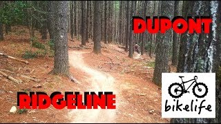
 DuPont Ridgeline
6.3 mi 10.1 km • 697' Up 212.55 m Up • 694' Down 211.63 m Down
Brevard, NC
 Pisgah Stage Race - Stage 3
31.4 mi 50.5 km • 5,727' Up 1745.44 m Up • 5,728' Down 1745.87 m Down
Brevard, NC
Pisgah 55.5K MTB Race
38.4 mi 61.8 km • 7,798' Up 2376.79 m Up • 7,800' Down 2377.3 m Down
Brevard, NC
Black Mountain Loop
13.7 mi 22.0 km • 2,147' Up 654.34 m Up • 2,106' Down 642.04 m Down
Brevard, NC
Turkeypen Gap to Black Mountain Loop
23.3 mi 37.5 km • 3,568' Up 1087.56 m Up • 3,570' Down 1088.22 m Down


 All Clear


0 Comments