Dogs Off-leash

Features
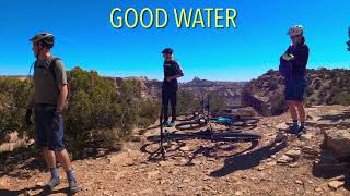
Views

Access not recommended on BLM roads following rain or snow.
Overview
This is a great cross-country ride with stunning views. It is best suited for intermediate to advanced riders. The trail has almost constant turns and up-and-downs as it skirts around two major canyons in the Swell. It features some rock ledges, but few over 12". The trail tread is made up of loose dirt and stone slabs with some small slickrock areas mixed in.
The riding is good in either direction, but most people seem to do it from west to east along the rim. You can easily make it a loop by riding an outer semi-circle of dirt roads between the two trailheads, or you can shuttle it with two cars. For double the views and twice the fun, just ride the whole thing as an out-n-back!
Need to Know
Access to pit toilets is limited, and there are no services in the area. The best practice is to come prepared with all you need, and to plan for packing out all human waste and trash.
Description
This area is very remote and features great dispersed BLM camping options. There are many access points to this area, although the easiest is starting at the town of Huntington. These are well-maintained roads, but they will be affected by rain or snow, so be sure to check the forecast. From Huntington, head south on Highway 10 about 7.5 miles, then take a left on the "San Rafael Access" road (County Rd 401). Take this maintained dirt road for about 12.5 miles, and at a big intersection turn right for an information kiosk, picnic area, and toilets. Review the map here and decide which trailhead you want to start from; most people start from the Little Grand Canyon Overlook.
Continue south on dirt roads for about 7.5 more miles to reach the overlook. This is an epic place to start a ride, overlooking a huge swath of the "Little Grand Canyon" of the San Rafael River. Begin riding on a doubletrack heading north. Look for cairns about half a mile along the road; this is where you join the singletrack.
You'll cross the road a few times in the next mile, but then you'll continue to travel on singletrack close to the canyon rim. There are a few misleading spur trails that take you to primitive campsites, but the main trail is marked in some places for your reference. The trail meets with dirt roads in a few stretches, most notably at the northernmost part of the route. This road is a good bail-out option if you don't want to complete the loop. The various intersections can be confusing, but downloading the map and GPX will help you stay on track.
Continuing the loop, you'll eventually return to the rim of the Little Grand Canyon, where you'll go east and find the doubletrack heading in the same direction. Ride the semi-circle of dirt roads to get back to your car in about 6 miles, or meet your second vehicle here if you've set one.
Contacts
Shared By:
neil jaquet
with improvements
by dean hill

 Continue with onX Maps
 Sign in with Facebook


 Intermediate

 4.6 (45)


 All Clear


9 Comments