
 Continue with onX Maps
 Sign in with Facebook


 Difficult

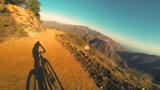
“Most of this route is forest road with spectacular views, but there is fun singletrack at each end. ”


5.4
Miles8.7
KMDoubletrack
 Difficult
Land Manager: Santa Monica Mountains National Recreation Area
 Corral Canyon Out and Back
12.3 mi 19.8 km • 2,095' Up 638.66 m Up • 2,095' Down 638.45 m Down

 Topanga Creek Outpost Loop
10.7 mi 17.3 km • 1,382' Up 421.1 m Up • 1,382' Down 421.23 m Down
 El Escorpion to Cheeseboro Loop
18.7 mi 30.1 km • 2,355' Up 717.71 m Up • 2,355' Down 717.89 m Down
Point Mugu Loop
15.4 mi 24.7 km • 2,070' Up 631.02 m Up • 2,070' Down 630.96 m Down
Camarillo, CA
Casa Viejo Loop
3.7 mi 5.9 km • 811' Up 247.25 m Up • 808' Down 246.25 m Down
Santa M…, CA
 Big Topanga Loop
21.5 mi 34.6 km • 3,257' Up 992.63 m Up • 3,254' Down 991.93 m Down


0 Comments