Dogs Leashed

E-Bikes
Not Allowed
Features
Views
Overview
This is one of the best intermediate-level rides in the area, taking a long and thrilling descent through burned forest, aspen glades, boulder fields, and open hillside from the top of the plateau down to Panguitch Lake. The trail starts with some chucky steepr sections, but morphs into fast and flowy dirt with just the right amount of rock rollers to keep things interesting, some of which are optional. Set your shuttle along the gravel road FR 081 to avoid the final pedal up to the highway, or finish by riding all the way to the Burger Barn and Panguitch Lake Store.
Need to Know
There is a restroom at the Trailhead and plenty of parking. Similarly there is parking along the first mile of FR 081 at the end of the trail, just off Hwy 143 for those who wish to self-shuttle.
For people bringing there dogs, be aware there are a variety of dogs bread to protect the sheep that graze in the area. If your dog chases these sheep these dogs will see your animal as a threat please try to avoid these situations as much as possible.
Description
You get epic views from the outset after a short rocky climb from the trailhead parking lot. Be prepared for some pedaling (at 10,000ft altitude!) along the Sidney Peaks Trail [portion] across a high alpine meadow, but after this it's mostly all downhill on wonderful flowing singletrack through the forest, now renamed 'North Fork' Bunker Creek.
Note the trail splits left and right at a wooden sign board just after you cross FR 048 at the cinder parking lot/overlook - North Fork (to the left) and South Fork (to the right) - North Fork is the recommended bike trail, but they do converge again further down the trail before the newly introduced lower singletrack section, south of the creek itself.
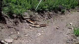
For pure adrenaline and enjoyment, this middle downhill singletrack portion is going to be the highlight for most people - with smooth flowing corners, switchbacks and some off-camber sections to navigate. Other than a few rocky/loose sections and small drops, there are currently no serious hazards/features to content with, so is suitable for most riders with some singletrack experience. Just watch out for downfall, as this trail goes through a heavily burned area of standing dead trees.
As the trail finally levels out in a small clearing, you now cross the creek to your right on a new wooden bridge (where the previous route used to continue straight to join FR 081), and continue on the south side on a newly introduced singletrack trail.
Initially there is some pedaling, but only to help you gain a little elevation to help maintain the general flow of the trail. It winds through rocks and trees (with some optional rock hops/jumps) and eventually rejoins the unpaved Forest Road much further east now, just a couple of miles from the highway.
Gravity is still on your side for the majority of this final section along FR 081, although it is worth noting that final half mile to Hwy 143 is slightly uphill on the wide gravel road, so if you're self-shuttling, consider parking closer to the creek itself if you want to avoid this. Otherwise it's ultimately a short coast downhill on Hwy 143 to the Burger Barn at Panguitch Lake, where the various shuttle service busses collect you.
You'll have earned your burger and shake!
History & Background
The Bunker Creek (North Fork - formally known as Right Fork) Trail has been updated for 2021, with a series of new singletrack sections in the lower half, together with some restored/rerouted singletrack from the summit down.
Contacts
Shared By:
Jenny Mo
with improvements
by Jesse Weber

 Continue with onX Maps
 Sign in with Facebook


 Intermediate

 4.7 (3)


0 Comments