
 Continue with onX Maps
 Sign in with Facebook


 Difficult

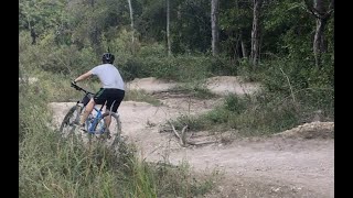
“A fun but very steep downhill track from the end of Powerline Flow Trail back down to the sidewalk. ”


0.2
Miles0.3
KMSingletrack
 Difficult
Local Club: Austin Ridge Riders (ARR)
Land Manager: City of Austin - Parks and Recreation

 Emma Long Motocross Park: Main Loop
5.7 mi 9.1 km • 529' Up 161.09 m Up • 529' Down 161.13 m Down

 Lost Creek, TX

 Hamilton Greenbelt & Hurst Hollow Preserve
4.4 mi 7.0 km • 278' Up 84.68 m Up • 276' Down 84.17 m Down
Lakeway, TX
Lakeway Greenbelt and City Park Tour
11.7 mi 18.9 km • 718' Up 218.71 m Up • 719' Down 219.09 m Down
 Lakeway Canyonlands & Mt. Lakeway Scenic View
5.8 mi 9.4 km • 799' Up 243.64 m Up • 799' Down 243.55 m Down
Lakeway, TX

 Pancho's Ride
4.7 mi 7.6 km • 160' Up 48.64 m Up • 161' Down 49 m Down
Lago Vista, TX
 Great Beginner-Intermediate Route
10.1 mi 16.2 km • 468' Up 142.51 m Up • 444' Down 135.22 m Down
Briarcliff, TX


1 Comment