
 Continue with onX Maps
 Sign in with Facebook


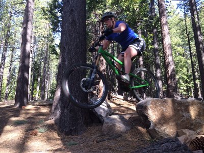
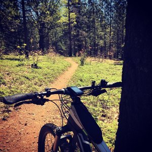
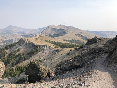
Electric MTB Friendly Trails and Rides
near Yosemite Valley, California
Yosemite Valley, California 
Recommended Routes, Photos, & More

 Intermediate/Difficult
Sidewinder Corral Ride
9.2 mi 14.7 km • 1,388' Up 423.1 m Up • 1,392' Down 424.23 m Down

 South L…, CA

 Intermediate
Salmon Falls (Darrington Trail)
15.9 mi 25.6 km • 717' Up 218.52 m Up • 717' Down 218.57 m Down
 Intermediate
Fleming Meadow Loop
6.5 mi 10.5 km • 949' Up 289.39 m Up • 979' Down 298.41 m Down
Pollock…, CA
Intermediate/Difficult
Corral Trail #18E14
2.2 mi 3.5 km • 46' Up 14.16 m Up • 715' Down 217.81 m Down
South L…, CA

 Difficult
007
4.9 mi 7.8 km • 106' Up 32.23 m Up • 1,944' Down 592.65 m Down
Oakhurst, CA
 Intermediate
Mountain View Trail
5.4 mi 8.7 km • 769' Up 234.44 m Up • 165' Down 50.34 m Down
Mammoth…, CA
 Difficult
Thunder Mountain Loop
11.1 mi 17.9 km • 2,073' Up 631.95 m Up • 2,071' Down 631.09 m Down
South L…, CA
 Intermediate
Uptown Downtown - Full Loop
9.3 mi 15.0 km • 949' Up 289.18 m Up • 948' Down 289.01 m Down
Mammoth…, CA

 Easy/Intermediate
Blue Oak Trail
3.3 mi 5.3 km • 42' Up 12.91 m Up • 47' Down 14.34 m Down
Bonadel…, CA
 Intermediate
Off the Top
5.1 mi 8.3 km • 3' Up 0.88 m Up • 1,538' Down 468.76 m Down
Mammoth…, CA
 Difficult
Twilight Zone
0.7 mi 1.2 km • 0' Up 0 m Up • 301' Down 91.87 m Down
Mammoth…, CA
 Difficult
Follow Me
1.8 mi 2.9 km • 0' Up 0 m Up • 1,201' Down 366.07 m Down
Mammoth…, CA
 Intermediate/Difficult
San Joaquin River Trail
14.5 mi 23.3 km • 2,110' Up 643.25 m Up • 2,564' Down 781.63 m Down
 No Photos
Intermediate/Difficult
No Photos
Intermediate/Difficult
Down and Out
1.6 mi 2.5 km • 0' Up 0 m Up • 690' Down 210.21 m Down
La Grange, CA
 Difficult
Shotgun
0.9 mi 1.5 km • 25' Up 7.72 m Up • 436' Down 132.95 m Down
Mammoth…, CA
 Intermediate
Beach Cruiser
5.9 mi 9.4 km • 584' Up 178.05 m Up • 535' Down 163.03 m Down
Mammoth…, CA
 Difficult
Buck Meadows
3.1 mi 4.9 km • 19' Up 5.76 m Up • 1,609' Down 490.57 m Down
Tuolumn…, CA
No Photos
 Easy
Easy
Clovis Trail (to Woodward Park)
3.3 mi 5.3 km • 18' Up 5.37 m Up • 31' Down 9.31 m Down
Clovis, CA
No Photos
Easy
Sugar Pine Trail
4.0 mi 6.4 km • 49' Up 14.95 m Up • 21' Down 6.29 m Down
Clovis, CA
 Intermediate/Difficult
Seven Bridges
0.8 mi 1.3 km • 42' Up 12.68 m Up • 297' Down 90.65 m Down
Mammoth…, CA
 Intermediate
Ranch Trail
0.6 mi 1.0 km • 120' Up 36.66 m Up • 19' Down 5.87 m Down
Pilot Hill, CA
 Intermediate
Forbidden Forest
0.5 mi 0.8 km • 0' Up 0 m Up • 167' Down 50.85 m Down
South L…, CA
 Intermediate
Olmstead Trail
9.1 mi 14.6 km • 917' Up 279.36 m Up • 914' Down 278.57 m Down
No Photos
Easy/Intermediate
Twisted Cedar Trail #18E14B
1.8 mi 2.8 km • 125' Up 38.2 m Up • 372' Down 113.51 m Down
South L…, CA
 Intermediate
Chaparral Ridge
3.0 mi 4.9 km • 610' Up 185.95 m Up • 583' Down 177.58 m Down
Pilot Hill, CA
 Intermediate/Difficult
Juniper
2.0 mi 3.1 km • 3' Up 0.95 m Up • 711' Down 216.69 m Down
 Intermediate/Difficult
Richter
0.4 mi 0.7 km • 0' Up 0 m Up • 193' Down 58.84 m Down
Mammoth…, CA
No Photos
Intermediate
Paper Route
3.3 mi 5.3 km • 288' Up 87.65 m Up • 106' Down 32.4 m Down
Mammoth…, CA


